10 SENECAL ST
Owner Information
MIRANDA MARK F
10 SENECAL ST
MANSFIELD, MA 02048


Property Details
10 SENECAL ST is classified as a Single Family Residential (Conventional).
The primary structure on this property was built in 1920. There are 2,846ft2 of built area within this property. There is 1,534ft2 of residential/living space within this property. This property is listed as having 8 rooms.
10 SENECAL ST is valued at $429,700. The land is valued at $211,500 and the structures are valued at $216,800. There is an additional valuation of $1,400 on this property.
The most recent deed for 10 SENECAL ST is recorded at the local registrar in Book 6474, Page 0078. 10 SENECAL ST was last sold on Monday, September 11, 1995 for $128,500.
Assessment data from fiscal year 2022.
Flood Data
According to the FEMA National Flood Hazard Layer, this property does not appear to be in a flood zone. It may also be in an area not yet reviewed. Nonetheless, confirm this information prior to taking any action.
To view the flood hazards around this property, create a FEMA "Firmette" Map of the area around 10 SENECAL ST.
Broadband Internet Providers
| Provider | Type | Bandwidth (mbps) | |
|---|---|---|---|
| HughesNet | Satellite | 25 | 3 |
| VSAT Systems, LLC. | Satellite | 2 | 1 |
| Comcast | Cable | 1000 | 35 |
| Viasat Inc | Satellite | 100 | 3 |
| Verizon New England Inc. | DSL | 10 | 1 |
| Verizon New England Inc. | Fiber | 940 | 880 |
| GCI Communication Corp. | Satellite | 0 | 0 |
Broadband service provider data from December 2020.
Adjacent Properties
- 561 NORTH MAIN ST
Two-Family Residential owned by MCLAUGHLIN MATTHEW J & ALISON R - 569 NORTH MAIN ST
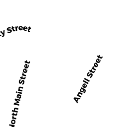
Single Family Residential owned by OKEEFE ROBERT & SANDRA - 17 SUMMIT AVE
Multiple Houses on one parcel owned by MAHONEY GEORGE - 56 ANGELL ST
Single Family Residential owned by PALMA JOHN F & LINDA B - 23 SUMMIT AVE
Single Family Residential owned by MAHONEY GEORGE D